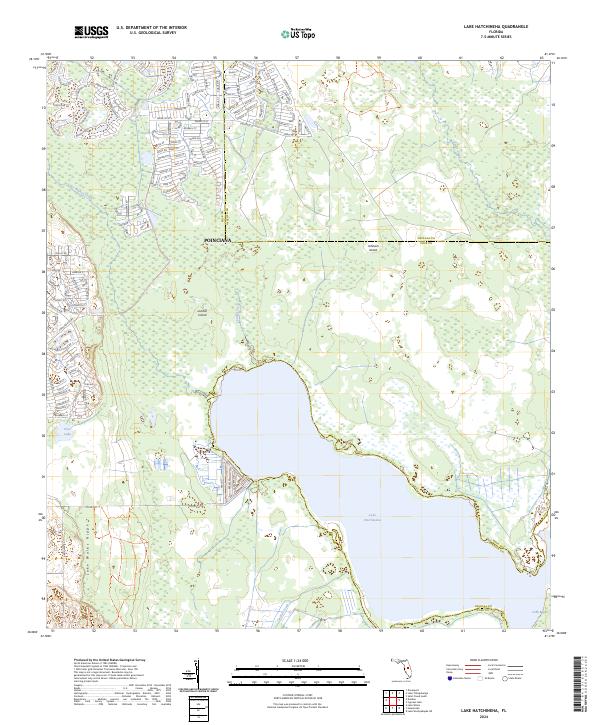
2024 Map of Lake Hatchineha
USGS Topo · Published 2024About this map
Poinciana spans the northern portion of this map, showcasing the dense residential street networks of this modern community. To the south, the landscape opens into the massive Everglades Headwaters National Wildlife Refuge And Conservation Area, a critical conservation corridor that protects the headwaters of the Florida Everglades. The sheet is dominated by the sprawling waters of Lake Hatchineha, where the Polk and Osceola county line crosses the lake bed. This area represents a complex hydrological system where the Lake Wales Ridge meets the marshes of the Kissimmee River basin. Notable topographical features like London Island and Johnson Island rise within the wetlands, while the Disney Wilderness Preserve Trl meanders through the northeast corner, illustrating the region's focus on ecological preservation alongside suburban development.
Find a feature on this map
23 named features on this map. Tap any name to fly to it.
Don’t see what you’re looking for? This feature index may not catch every label — zoom into the map to look around manually.
Map Details
Editions of this 2024 Lake Hatchineha Map
This is the sole edition of this map. No revisions or reprints were ever made.
Other maps of this area

1952 · Lake Wales
USGS Topo · 1:24,000

1952 · Lake Weohyakapka NE
USGS Topo · 1:24,000

1952 · Hesperides
USGS Topo · 1:24,000

1953 · Cypress Lake
USGS Topo · 1:24,000

1953 · Dundee
USGS Topo · 1:24,000

1953 · Lake Hatchineha
USGS Topo · 1:24,000

1953 · St Cloud South
USGS Topo · 1:24,000

1953 · Lake Tohopekaliga
USGS Topo · 1:24,000

1953 · Davenport
USGS Topo · 1:24,000

1955 · Orlando
USGS Topo · 1:250,000