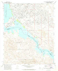
1970 Map of Lake Havasu City South
USGS Topo · Published 1973About this map
Lake Havasu City expands across the shoreline in the early 1970s, a period of rapid development following the master-planned vision of Robert P. McCulloch. The suburban street grid, including the Lake Havasu Golf & Country Club, High Sch, and Jr High Sch, contrasts sharply with the desert terrain of the Chemehuevi Indian Reservation to the south. The shoreline is dominated by Lake Havasu State Park, where landmarks like Pittsburg Point and Thompson Bay highlight the area's transition into a major recreational hub. In the southern reaches of the quadrangle, the landscape remains largely untamed, featuring natural landmarks like Pilot Rock and Steamboat Rock along the Colorado River, while the Roulette Mine sits tucked into the foothills of the Whipple Mountains, reflecting the region's older prospecting history.
Find a feature on this map
26 named features on this map. Tap any name to fly to it.
Don’t see what you’re looking for? This feature index may not catch every label — zoom into the map to look around manually.
Map Details
Editions of this 1970 Lake Havasu City South Map
3 editions found
Other maps of this area

1903 · Needles
USGS Topo · 1:125,000

1904 · Needles Special
USGS Topo · 1:125,000

1911 · Parker
USGS Topo · 1:125,000

1927 · Buck Mountains
USGS Topo · 1:62,500

1929 · Buck Mountains
USGS Topo · 1:62,500

1943 · Giers Basin
USGS Topo · 1:62,500

1943 · Topock
USGS Topo · 1:62,500

1943 · Whipple Mts.
USGS Topo · 1:62,500

1950 · Parker Dam Area
USGS Topo · 1:62,500

1950 · Topock
USGS Topo · 1:62,500