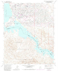
1970 Map of Lake Havasu City South
USGS Topo · Published 1984About this map
Lake Havasu City is captured here during a pivotal decade of development following its founding, showing the early infrastructure of this desert oasis along the Colorado River. The map marks the presence of the London Bridge, which had only recently been reconstructed across a newly dredged channel to Pittsburg Point. This engineering feat transformed the local geography, creating the peninsula that defines Thompson Bay.
Find a feature on this map
37 named features on this map. Tap any name to fly to it.
Don’t see what you’re looking for? This feature index may not catch every label — zoom into the map to look around manually.
Map Details
Editions of this 1970 Lake Havasu City South Map
3 editions found
Other maps of this area

1903 · Needles
USGS Topo · 1:125,000

1904 · Needles Special
USGS Topo · 1:125,000

1911 · Parker
USGS Topo · 1:125,000

1927 · Buck Mountains
USGS Topo · 1:62,500

1929 · Buck Mountains
USGS Topo · 1:62,500

1943 · Giers Basin
USGS Topo · 1:62,500

1943 · Topock
USGS Topo · 1:62,500

1943 · Whipple Mts.
USGS Topo · 1:62,500

1950 · Parker Dam Area
USGS Topo · 1:62,500

1950 · Topock
USGS Topo · 1:62,500