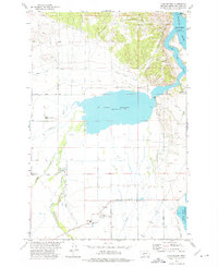
1972 Map of Lake Helena
USGS Topo · Published 1975About this map
Lake Helena and the Missouri River corridor define this 1970s landscape northeast of the state capital. The irrigation and water management infrastructure of the valley is evident through the Helena Valley Canal, Floweree Canal, and the Helena Valley Regulating Reservoir. Local social centers are well-documented, including the Masonic Home and the Community Center, alongside rural education sites like Mountain View Sch and Warren Sch. Toward the northeast, the terrain shifts near Hauser Lake, where evidence of extraction appears at several Prospects and a Mine. The map captures a mix of established residential patterns at the Trailer Park and agricultural transport along York Road and Lincoln Road East, illustrating the functional layout of the valley before late-century suburban expansion.
Find a feature on this map
29 named features on this map. Tap any name to fly to it.
Don’t see what you’re looking for? This feature index may not catch every label — zoom into the map to look around manually.
Map Details
Editions of this 1972 Lake Helena Map
2 editions found
Other maps of this area

1886 · Fort Logan
USGS Topo · 1:250,000

1889 · Helena
USGS Topo · 1:250,000

1893 · Helena
USGS Topo · 1:250,000

1899 · Helena
USGS Topo · 1:62,500

1899 · Helena
USGS Topo · 1:250,000

1903 · Helena
USGS Topo · 1:250,000

1947 · Butte
USGS Topo · 1:250,000

1948 · White Sulphur Springs
USGS Topo · 1:250,000

1950 · East Helena
USGS Topo · 1:62,500

1950 · Helena
USGS Topo · 1:62,500