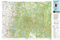
1985 Map of Lake Itasca
USGS Topo · Published 1994About this map
White Earth Indian Reservation dominates this landscape of glacial lakes and forests during the mid-1980s. The region is defined by its complex hydrology, featuring the legendary Lake Itasca, known as the source of the Mississippi River. This map captures the transition from the prairie-fringe settlements along the western edge to the dense woodlands of the east. The Soo Line railroad serves as the primary industrial corridor, connecting towns like Mahnomen, Waubun, and Ogema.
Find a feature on this map
71 named features on this map. Tap any name to fly to it.
Don’t see what you’re looking for? This feature index may not catch every label — zoom into the map to look around manually.
Map Details
Editions of this 1985 Lake Itasca Map
2 editions found
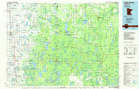
Other maps of this area

1918 · Flom
USGS Topo · 1:62,500

1919 · Fosston
USGS Topo · 1:62,500

1919 · Solway
USGS Topo · 1:62,500

1919 · Valley
USGS Topo · 1:62,500

1920 · Buena Vista
USGS Topo · 1:62,500

1943 · Solway
USGS Topo · 1:62,500

1943 · Bagley
USGS Topo · 1:62,500

1952 · Grand Forks
USGS Topo · 1:250,000

1953 · Fargo
USGS Topo · 1:250,000

1953 · Brainerd
USGS Topo · 1:250,000