
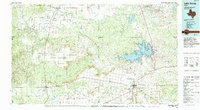
1985 Map of Lake Kemp
USGS Topo · Published 1985About this map
The Brazos River and the winding course of the North Wichita River dominate this mid-1980s look at the rolling plains of North Texas. Large-scale water management is a defining characteristic of the landscape, centered on the sprawling Lake Kemp and the smaller Lake Davis and Santa Rosa Lake. The map details a region where the agricultural economy is tied closely to the river systems and the transportation corridors provided by the Burlington Northern and Atchison Topeka and Santa Fe railroads.
Find a feature on this map
41 named features on this map. Tap any name to fly to it.
Don’t see what you’re looking for? This feature index may not catch every label — zoom into the map to look around manually.
Map Details
Editions of this 1985 Lake Kemp Map
2 editions found
Other maps of this area

1916 · Electra
USGS Topo · 1:24,000

1917 · Beaver Creek
USGS Topo · 1:24,000

1918 · Electra
USGS Topo · 1:31,680

1920 · Beaver Creek
USGS Topo · 1:31,680

1932 · Vivian
USGS Topo · 1:62,500

1932 · Dundee
USGS Topo · 1:62,500

1954 · Lubbock
USGS Topo · 1:250,000

1954 · Plainview
USGS Topo · 1:250,000

1954 · Wichita Falls
USGS Topo · 1:250,000

1955 · Lawton
USGS Topo · 1:250,000