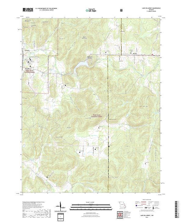
2021 Map of Lake Killarney
USGS Topo · Published 2021About this map
The Saint Francois Mountains dominate this landscape, where the neighboring settlements of Ironton and Arcadia sit at the western edge of a terrain defined by narrow hollows and high peaks. The 2021 data reflects a region deeply layered with local history, evidenced by the high density of burial grounds including Masonic Cem, the Knights of Pythias Cem, and Rebel Cem. To the east, the community of Roselle is positioned near the Iron Co Madison Co line, while the resort-oriented Killarney Shores borders a prominent local waterway.
Find a feature on this map
64 named features on this map. Tap any name to fly to it.
Don’t see what you’re looking for? This feature index may not catch every label — zoom into the map to look around manually.
Map Details
Editions of this 2021 Lake Killarney Map
This is the sole edition of this map. No revisions or reprints were ever made.
Other maps of this area

1926 · Des Arc
USGS Topo · 1:62,500

1929 · Des Arc
USGS Topo · 1:62,500

1930 · Coldwater
USGS Topo · 1:62,500

1937 · Ironton
USGS Topo · 1:48,000

1939 · Fredericktown
USGS Topo · 1:48,000

1945 · Ironton
USGS Topo · 1:62,500

1946 · Ironton
USGS Topo · 1:62,500

1947 · Fredericktown
USGS Topo · 1:62,500

1949 · Rolla
USGS Topo · 1:250,000

1949 · Coldwater
USGS Topo · 1:62,500