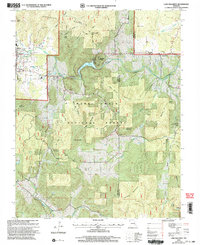
2000 Map of Lake Killarney
USGS Topo · Published 2003About this map
Ironton and Arcadia anchor the northwestern corner of this study, positioned near the rugged foot of Anderson Mountain and Pilot Knob. This area of the St. Francois Mountains is defined by its deep drainages and notable geologic formations, such as the Shut-Ins along Stouts Creek. Much of the quadrangle is occupied by the Mark Twain National Forest, where high ridges like Crane Mountain and Tims Mountain rise above the surrounding creek valleys.
Find a feature on this map
43 named features on this map. Tap any name to fly to it.
Don’t see what you’re looking for? This feature index may not catch every label — zoom into the map to look around manually.
Map Details
Editions of this 2000 Lake Killarney Map
This is the sole edition of this map. No revisions or reprints were ever made.
Other maps of this area

1926 · Des Arc
USGS Topo · 1:62,500

1929 · Des Arc
USGS Topo · 1:62,500

1930 · Coldwater
USGS Topo · 1:62,500

1937 · Ironton
USGS Topo · 1:48,000

1939 · Fredericktown
USGS Topo · 1:48,000

1945 · Ironton
USGS Topo · 1:62,500

1946 · Ironton
USGS Topo · 1:62,500

1947 · Fredericktown
USGS Topo · 1:62,500

1949 · Rolla
USGS Topo · 1:250,000

1949 · Coldwater
USGS Topo · 1:62,500