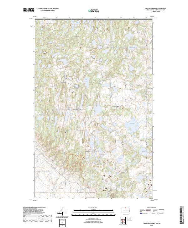
2024 Map of Lake Klingenberg
USGS Topo · Published 2024About this map
The Turtle Mountains dominate this northern Bottineau County landscape, characterized by a dense network of glacial prairie potholes and small lakes. In the mid-2020s, much of the area remains dedicated to wildlife conservation, notably within the Bottineau County Waterfowl Production Area. This specific topography of wetland depressions includes named bodies of water such as Lake Couthard, Harts Lake, and Lake Harman.
Find a feature on this map
29 named features on this map. Tap any name to fly to it.
Don’t see what you’re looking for? This feature index may not catch every label — zoom into the map to look around manually.
Map Details
Editions of this 2024 Lake Klingenberg Map
This is the sole edition of this map. No revisions or reprints were ever made.
Other maps of this area

1954 · Souris SE
USGS Topo · 1:24,000

1954 · Minot
USGS Topo · 1:250,000

1955 · Bottineau
USGS Topo · 1:24,000

1955 · Bottineau SE
USGS Topo · 1:24,000

1956 · Metigoshe Lake
USGS Topo · 1:24,000

1956 · Carbury
USGS Topo · 1:24,000

1956 · Lake McArthur
USGS Topo · 1:24,000

1958 · Minot
USGS Topo · 1:250,000

1980 · Bottineau
USGS Topo · 1:100,000
2011 · Carbury
USGS Topo · 1:24,000