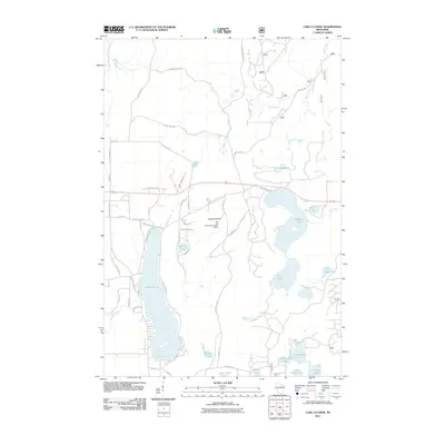
2011 Map of Lake Lucerne
USGS Topo · Published 2011About this map
Sugarbush Hill dominates the central landscape of this Forest County region, serving as a geographic anchor near the Rat Lake Permanent Lookout Station. The area is defined by a dense network of glacial lakes and waterways, including the expansive Lake Lucerne and the connected waters of Wabikon Lake and Riley Lake. A complex system of named roads and trails, such as the Potawatomi Mile Trl and Potawatomi Trl, suggests a landscape heavily utilized for seasonal recreation and timber management. The drainage patterns of the South Branch Peshtigo River and the Indian River highlight the hydrologic importance of this northern Wisconsin terrain. Smaller water bodies like Devils Lake and Bug Lake are interspersed among family-named routes like Billy Daniels Ln and Jim Daniels Ln, providing specific points of interest for local history researchers.
Find a feature on this map
58 named features on this map. Tap any name to fly to it.
Don’t see what you’re looking for? This feature index may not catch every label — zoom into the map to look around manually.
Map Details
Editions of this 2011 Lake Lucerne Map
This is the sole edition of this map. No revisions or reprints were ever made.
Other maps of this area

1939 · Crandon
USGS Topo · 1:48,000

1939 · Laona
USGS Topo · 1:48,000

1941 · Crandon
USGS Topo · 1:48,000

1942 · Wabeno
USGS Topo · 1:48,000

1942 · Pearson
USGS Topo · 1:48,000

1946 · Laona
USGS Topo · 1:48,000

1947 · Crandon
USGS Topo · 1:48,000

1950 · Wabeno
USGS Topo · 1:48,000

1950 · Lily
USGS Topo · 1:48,000

1951 · Wabeno
USGS Topo · 1:48,000