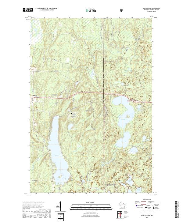
2022 Map of Lake Lucerne
USGS Topo · Published 2022About this map
Lake Lucerne and the surrounding woodlands of the Nicolet National Forest characterize this part of Forest County, recorded here in the early 21st century. The landscape is a network of water and local trails, featuring numerous glacial lakes such as Wabikon Lake, Riley Lake, and Dawson Lake. Near the center of the sheet, Sugarbush Hill rises as a prominent landmark north of the Potawatomi Tribal Cem, highlighting the indigenous heritage of the region. The map shows the eastern edges of Crandon, with roads like Lake Lucerne Dr and Co Hwy W providing access to the various waterfronts. This survey is particularly useful for identifying the complex system of forest roads and trails, including Potawatomi Trl and Mish Ko Swen Dr, which connect these isolated water bodies and wetlands.
Find a feature on this map
68 named features on this map. Tap any name to fly to it.
Don’t see what you’re looking for? This feature index may not catch every label — zoom into the map to look around manually.
Map Details
Editions of this 2022 Lake Lucerne Map
This is the sole edition of this map. No revisions or reprints were ever made.
Other maps of this area

1939 · Crandon
USGS Topo · 1:48,000

1939 · Laona
USGS Topo · 1:48,000

1941 · Crandon
USGS Topo · 1:48,000

1942 · Wabeno
USGS Topo · 1:48,000

1942 · Pearson
USGS Topo · 1:48,000

1946 · Laona
USGS Topo · 1:48,000

1947 · Crandon
USGS Topo · 1:48,000

1950 · Wabeno
USGS Topo · 1:48,000

1950 · Lily
USGS Topo · 1:48,000

1951 · Wabeno
USGS Topo · 1:48,000