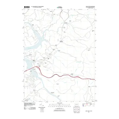
2011 Map of Lake Lynn
USGS Topo · Published 2011About this map
Clay Furnace and the site of the Laurel Iron Works highlight the industrial history found along the southern portion of this landscape, where early manufacturing utilized the local resources of the Chestnut Ridge. The rugged terrain is carved by numerous drainages, including Quarry Run and Morgan Run, which flow into the expansive waters of Cheat Lake. This reservoir is formed by the Lake Lynn Dam, altering the original course of the Cheat River and submerging landmarks like Grassy Island.
Find a feature on this map
86 named features on this map. Tap any name to fly to it.
Don’t see what you’re looking for? This feature index may not catch every label — zoom into the map to look around manually.
Map Details
Editions of this 2011 Lake Lynn Map
This is the sole edition of this map. No revisions or reprints were ever made.
Other maps of this area

1900 · Uniontown
USGS Topo · 1:62,500

1900 · Masontown
USGS Topo · 1:62,500

1902 · Morgantown
USGS Topo · 1:62,500

1903 · Masontown
USGS Topo · 1:62,500

1904 · Bruceton
USGS Topo · 1:62,500

1925 · Morgantown
USGS Topo · 1:62,500

1926 · Bruceton
USGS Topo · 1:62,500

1931 · Uniontown
USGS Topo · 1:62,500

1931 · Masontown
USGS Topo · 1:62,500

1931 · Bruceton Mills
USGS Topo · 1:62,500