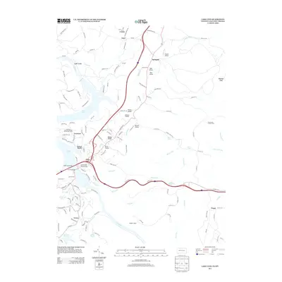
2013 Map of Lake Lynn
USGS Topo · Published 2013About this map
Cheat Lake and the winding Cheat River define this borderlands region between Pennsylvania and West Virginia. Along the eastern banks, residential developments like Greystone and Sunset Beach contrast with the rugged topography of Coopers Rock and numerous steep ravines such as Ryan Hollow and Johnson Hollow. The map reveals a transition from the structured fairways of the Lakeview Golf Resort and Spa Lakeview Course to the rural northern settlements of Gans and Crystal.
Find a feature on this map
145 named features on this map. Tap any name to fly to it.
Don’t see what you’re looking for? This feature index may not catch every label — zoom into the map to look around manually.
Map Details
Editions of this 2013 Lake Lynn Map
This is the sole edition of this map. No revisions or reprints were ever made.
Other maps of this area

1900 · Uniontown
USGS Topo · 1:62,500

1900 · Masontown
USGS Topo · 1:62,500

1902 · Morgantown
USGS Topo · 1:62,500

1903 · Masontown
USGS Topo · 1:62,500

1904 · Bruceton
USGS Topo · 1:62,500

1925 · Morgantown
USGS Topo · 1:62,500

1926 · Bruceton
USGS Topo · 1:62,500

1931 · Uniontown
USGS Topo · 1:62,500

1931 · Masontown
USGS Topo · 1:62,500

1931 · Bruceton Mills
USGS Topo · 1:62,500