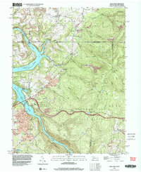
1997 Map of Lake Lynn
USGS Topo · Published 2000About this map
The Cheat River corridor defines this borderland landscape between Pennsylvania and West Virginia during the late 1990s. The impounded waters of Cheat Lake dominate the western terrain, supporting local infrastructure like the Power Station near the community of Lake Lynn. The map reveals a transition from industrial activity to protected natural spaces, with extensive Strip Mines visible on the ridges while the southern portion is preserved within the Coopers Rock State Forest.
Find a feature on this map
57 named features on this map. Tap any name to fly to it.
Don’t see what you’re looking for? This feature index may not catch every label — zoom into the map to look around manually.
Map Details
Editions of this 1997 Lake Lynn Map
2 editions found
Other maps of this area

1900 · Uniontown
USGS Topo · 1:62,500

1900 · Masontown
USGS Topo · 1:62,500

1902 · Morgantown
USGS Topo · 1:62,500

1903 · Masontown
USGS Topo · 1:62,500

1904 · Bruceton
USGS Topo · 1:62,500

1925 · Morgantown
USGS Topo · 1:62,500

1926 · Bruceton
USGS Topo · 1:62,500

1931 · Uniontown
USGS Topo · 1:62,500

1931 · Masontown
USGS Topo · 1:62,500

1931 · Bruceton Mills
USGS Topo · 1:62,500