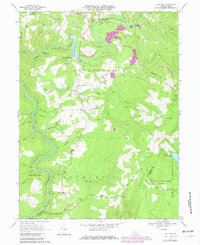
1967 Map of Mill Run
USGS Topo · Published 1980About this map
Indian Creek carves a deep valley through the northern landscape of this map, where the Baltimore and Ohio railroad corridor tracks alongside the water through Mill Run Junction and White Bridge. The rugged topography of Laurel Hill and Laurel Ridge dominates the eastern and southern portions, providing a natural setting for State Game Lands No 111 and the expansive Ohiopyle State Park along the Youghiogheny River. This 1967 survey, with purple revisions from 1980, captures the rural character of Springfield and Stewart townships.
Find a feature on this map
56 named features on this map. Tap any name to fly to it.
Don’t see what you’re looking for? This feature index may not catch every label — zoom into the map to look around manually.
Map Details
Editions of this 1967 Mill Run Map
Other maps of this area

1900 · Uniontown
USGS Topo · 1:62,500

1902 · Connellsville
USGS Topo · 1:62,500

1922 · Confluence
USGS Topo · 1:62,500

1922 · Donegal
USGS Topo · 1:62,500

1931 · Connellsville
USGS Topo · 1:62,500

1931 · Uniontown
USGS Topo · 1:62,500

1931 · Confluence
USGS Topo · 1:62,500

1933 · Confluence
USGS Topo · 1:62,500

1935 · Donegal
USGS Topo · 1:62,500

1936 · Connellsville
USGS Topo · 1:62,500
Featured Places
- Springfield Township, PA
- Lower Turkeyfoot Township, PA
- Dunbar Township, PA
- Stewart Township, PA
- Rogers Mill, Springfield Township