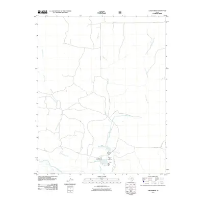
2010 Map of Lake Marvin
USGS Topo · Published 2010About this map
Boggy Creek and its eastern fork wind through the panhandle terrain of Hemphill County, converging near a cluster of managed water resources and recreational sites. This 2010 survey highlights the local significance of the M K Brown Reservoir and Lake Marvin, both formed by their respective dams. These water bodies serve as the primary focus for the surrounding landscape, providing the basis for the Lake Marvin Campground and the Old Military Road Campground.
Find a feature on this map
16 named features on this map. Tap any name to fly to it.
Don’t see what you’re looking for? This feature index may not catch every label — zoom into the map to look around manually.
Map Details
Editions of this 2010 Lake Marvin Map
This is the sole edition of this map. No revisions or reprints were ever made.
Other maps of this area

1954 · Perryton
USGS Topo · 1:250,000

1954 · Amarillo
USGS Topo · 1:250,000

1958 · Perryton
USGS Topo · 1:250,000

1958 · Amarillo
USGS Topo · 1:250,000

1967 · Gem
USGS Topo · 1:24,000

1967 · Blue Ridge School
USGS Topo · 1:24,000

1967 · Canadian SE
USGS Topo · 1:24,000

1972 · Canadian East
USGS Topo · 1:24,000

1972 · Glazier
USGS Topo · 1:24,000
1972 · Lake Marvin
USGS Topo · 1:24,000