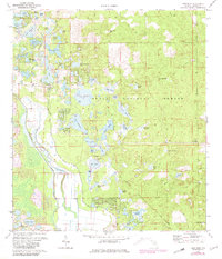
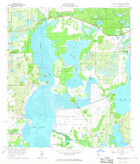
1972 Map of Lake Mary
USGS Topo · Published 1981About this map
The Oklawaha River corridor and the western reaches of the Ocala National Forest define this 1970s Florida landscape. The settlement at Moss Bluff serves as a local hub, featuring the Moss Bluff Ch and a nearby Cem, while recreational and social sites like Camp Oklawaha and Big Scrub Camp are situated among the dense network of wetlands and pine flatwoods.
Find a feature on this map
51 named features on this map. Tap any name to fly to it.
Don’t see what you’re looking for? This feature index may not catch every label — zoom into the map to look around manually.
Map Details
Editions of this 1972 Lake Mary Map
3 editions found
Other maps of this area

1954 · Daytona Beach
USGS Topo · 1:250,000

1955 · Orlando
USGS Topo · 1:250,000

1957 · Orlando
USGS Topo · 1:250,000

1958 · Orlando
USGS Topo · 1:250,000

1958 · Daytona Beach
USGS Topo · 1:250,000

1962 · Orlando
USGS Topo · 1:250,000

1964 · Daytona Beach
USGS Topo · 1:250,000

1965 · Umatilla
USGS Topo · 1:24,000
1966 · Lady Lake
USGS Topo · 1:24,000
1966 · Emeralda Island
USGS Topo · 1:24,000