
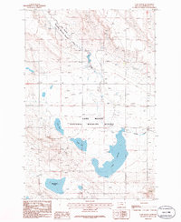
1986 Map of Lake Mason NE
USGS Topo · Published 1986About this map
Devils Basin dominates this 1986 survey of central Montana, where the terrain transitions across the boundary between Petroleum and Musselshell counties. The landscape is defined by the drainage patterns of Little Wall Creek to the north and North Willow Creek to the south. This area illustrates a mid-century ranching and resource extraction economy, with scattered corrals indicating active livestock management and a Gravel Pit highlighting local industrial activity. The elevation at Sunlight provides a landmark point amidst the complex ridgelines and coulees that characterize this part of the state before modern large-scale development shifted the rural character.
Find a feature on this map
7 named features on this map. Tap any name to fly to it.
Don’t see what you’re looking for? This feature index may not catch every label — zoom into the map to look around manually.
Map Details
Editions of this 1986 Lake Mason NE Map
This is the sole edition of this map. No revisions or reprints were ever made.
Other maps of this area

1954 · Roundup
USGS Topo · 1:250,000

1958 · Roundup
USGS Topo · 1:250,000

1986 · Lake Mason SE
USGS Topo · 1:24,000

1986 · Pike Creek Hills West
USGS Topo · 1:24,000

1986 · Lake Mason NW
USGS Topo · 1:24,000

1986 · Flatwillow
USGS Topo · 1:24,000

1986 · Pike Creek Hills East
USGS Topo · 1:24,000

1986 · Big Wall West
USGS Topo · 1:24,000

1986 · Big Wall NW
USGS Topo · 1:24,000
1986 · Lake Mason
USGS Topo · 1:24,000