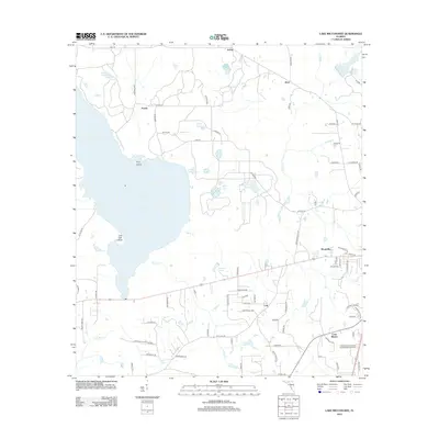
2012 Map of Lake Miccosukee
USGS Topo · Published 2012About this map
Lake Miccosukee dominates this landscape in Jefferson County, where the sprawling waterbody meets the drainage of Wards Cr and Caney Cr. The shoreline is punctuated by prominent landforms like Pine Island and Live Oak Point, while the surrounding wetlands and flatlands are dotted with smaller water features such as Perkins Plantation Pond and Norrias Club Pond. The map reveals a network of rural settlements including Festus, Alma, and Jarrett to the north, and Lois and Montivilla further south.
Find a feature on this map
81 named features on this map. Tap any name to fly to it.
Don’t see what you’re looking for? This feature index may not catch every label — zoom into the map to look around manually.
Map Details
Editions of this 2012 Lake Miccosukee Map
This is the sole edition of this map. No revisions or reprints were ever made.
Other maps of this area

1954 · Lloyd
USGS Topo · 1:24,000

1954 · Valdosta
USGS Topo · 1:250,000

1954 · Tallahassee
USGS Topo · 1:250,000

1955 · Lamont
USGS Topo · 1:24,000

1955 · Waukeenah
USGS Topo · 1:24,000

1956 · Monticello NE
USGS Topo · 1:24,000

1956 · Metcalf
USGS Topo · 1:24,000

1957 · Miccosukee NE
USGS Topo · 1:24,000

1958 · Valdosta
USGS Topo · 1:250,000

1959 · Tallahassee
USGS Topo · 1:250,000