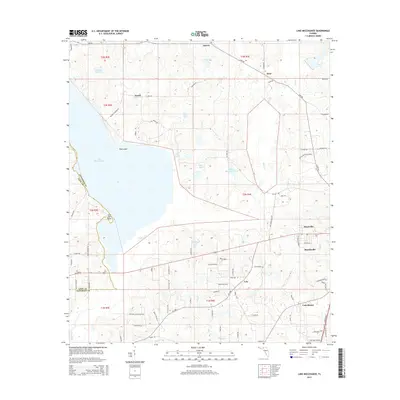
2015 Map of Lake Miccosukee
USGS Topo · Published 2015About this map
Lake Miccosukee dominates the western half of this Florida panhandle landscape, forming a natural boundary between Leon and Jefferson Counties. Along its northern shores, small settlements like Festus, Jarrett, and Alma are connected by Lake Rd and Alma Rd, reflecting the rural character of the region. The map captures a significant agricultural and residential heritage, marked by landmarks such as the Turtle Dove Plantation and Perkins Rd. To the southeast, the geography transitions into the outskirts of Monticello and Montivilla, where the road network densifies near the historical namesake of Casa Bianca. Several smaller water bodies including White Pond, Open Pond, and Rainey Lake punctuate the terrain between the larger lake and the flowing reaches of Wards Creek and Caney Creek.
Find a feature on this map
117 named features on this map. Tap any name to fly to it.
Don’t see what you’re looking for? This feature index may not catch every label — zoom into the map to look around manually.
Map Details
Editions of this 2015 Lake Miccosukee Map
This is the sole edition of this map. No revisions or reprints were ever made.
Other maps of this area

1954 · Lloyd
USGS Topo · 1:24,000

1954 · Valdosta
USGS Topo · 1:250,000

1954 · Tallahassee
USGS Topo · 1:250,000

1955 · Lamont
USGS Topo · 1:24,000

1955 · Waukeenah
USGS Topo · 1:24,000

1956 · Monticello NE
USGS Topo · 1:24,000

1956 · Metcalf
USGS Topo · 1:24,000

1957 · Miccosukee NE
USGS Topo · 1:24,000

1958 · Valdosta
USGS Topo · 1:250,000

1959 · Tallahassee
USGS Topo · 1:250,000