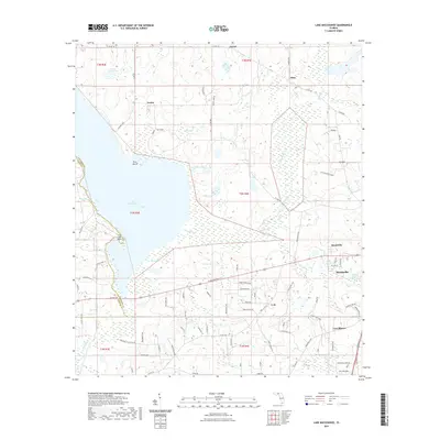
2021 Map of Lake Miccosukee
USGS Topo · Published 2021About this map
Lake Miccosukee dominates the western half of this Florida panhandle landscape, with its eastern shoreline defining the transition toward the seat of Jefferson County. The town of Monticello anchors the eastern edge of the survey, where residential streets like Willow Rd give way to the more rural outskirts of Montivilla. This area exhibits a distinct wetland-to-upland pattern, characterized by numerous smaller water bodies such as Mays Pond, Little Lake, and Open Pond that dot the interior timber and agricultural lands.
Find a feature on this map
95 named features on this map. Tap any name to fly to it.
Don’t see what you’re looking for? This feature index may not catch every label — zoom into the map to look around manually.
Map Details
Editions of this 2021 Lake Miccosukee Map
This is the sole edition of this map. No revisions or reprints were ever made.
Other maps of this area

1954 · Lloyd
USGS Topo · 1:24,000

1954 · Valdosta
USGS Topo · 1:250,000

1954 · Tallahassee
USGS Topo · 1:250,000

1955 · Lamont
USGS Topo · 1:24,000

1955 · Waukeenah
USGS Topo · 1:24,000

1956 · Monticello NE
USGS Topo · 1:24,000

1956 · Metcalf
USGS Topo · 1:24,000

1957 · Miccosukee NE
USGS Topo · 1:24,000

1958 · Valdosta
USGS Topo · 1:250,000

1959 · Tallahassee
USGS Topo · 1:250,000