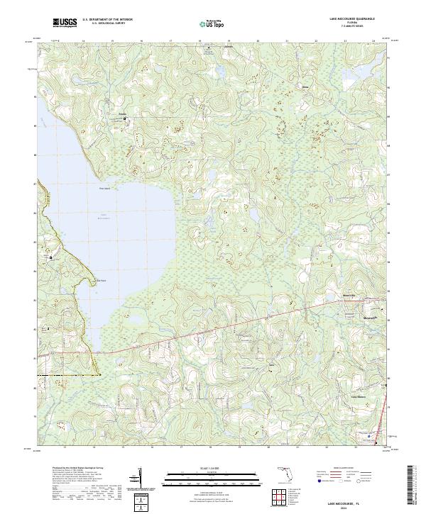
2024 Map of Lake Miccosukee
USGS Topo · Published 2024About this map
Lake Miccosukee dominates this landscape, its expansive waters and intricate wetlands shaped by Pine Island and the smaller Little Lake. In the northern stretches, religious and community life centers around Mount Olive A M E Church and Ford Chapel A M E Church, both of which maintain associated cemeteries that are vital for local genealogical research. The settlement pattern transitions from the rural clusters of Jarrett and Festus down toward the more developed area of Monticello in the southeast. Numerous named water bodies like Mays Pond and Raineys Lake dot the terrain, reflecting the region's high water table and natural drainage into Wards Creek and Caney Creek. These features illustrate the enduring rural character of Jefferson County, where old family cemeteries like Alston Cem and Byrd Cem remain as markers of long-established communities.
Find a feature on this map
102 named features on this map. Tap any name to fly to it.
Don’t see what you’re looking for? This feature index may not catch every label — zoom into the map to look around manually.
Map Details
Editions of this 2024 Lake Miccosukee Map
This is the sole edition of this map. No revisions or reprints were ever made.
Other maps of this area

1954 · Lloyd
USGS Topo · 1:24,000

1954 · Valdosta
USGS Topo · 1:250,000

1954 · Tallahassee
USGS Topo · 1:250,000

1955 · Lamont
USGS Topo · 1:24,000

1955 · Waukeenah
USGS Topo · 1:24,000

1956 · Monticello NE
USGS Topo · 1:24,000

1956 · Metcalf
USGS Topo · 1:24,000

1957 · Miccosukee NE
USGS Topo · 1:24,000

1958 · Valdosta
USGS Topo · 1:250,000

1959 · Tallahassee
USGS Topo · 1:250,000