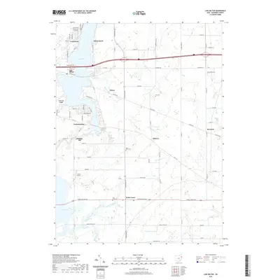
2019 Map of Lake Milton
USGS Topo · Published 2019About this map
The Mahoning River corridor and its expansive reservoir systems define this portion of Mahoning County. The northern landscape is centered on Lake Milton, where the resort-oriented developments of Craig Beach and Sunset Beach sit along the shoreline. Further south, the river transitions into Berlin Lake, creating a complex network of waterways fed by Turkey Broth Creek and Mill Creek. This 2019 survey documents the rural character of the region, anchored by the community of Berlin Center and smaller settlements like Fredericksburg and Shiltown.
Find a feature on this map
62 named features on this map. Tap any name to fly to it.
Don’t see what you’re looking for? This feature index may not catch every label — zoom into the map to look around manually.
Map Details
Editions of this 2019 Lake Milton Map
This is the sole edition of this map. No revisions or reprints were ever made.
Other maps of this area

1906 · Ravenna
USGS Topo · 1:62,500

1908 · Warren
USGS Topo · 1:62,500

1908 · Ravenna
USGS Topo · 1:62,500

1909 · Alliance
USGS Topo · 1:62,500

1909 · Lisbon
USGS Topo · 1:62,500

1950 · Cleveland
USGS Topo · 1:250,000

1951 · Canton
USGS Topo · 1:250,000

1952 · Lake Milton
USGS Topo · 1:24,000

1952 · Canfield
USGS Topo · 1:24,000

1952 · Alliance
USGS Topo · 1:24,000