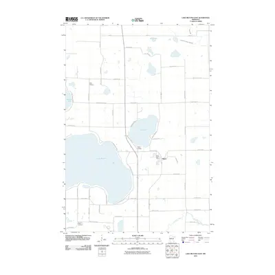
2010 Map of Lake Miltona East
USGS Topo · Published 2010About this map
Lake Miltona dominates this landscape in central Minnesota, serving as a primary focal point for the surrounding community of Miltona. The settlement is closely tied to the water, with numerous access roads like N Lake Miltona Dr NE and S Lake Miltona Dr NE tracing the shoreline. The interior land is punctuated by smaller basins including Lake Irene, Rainy Lake, and Vermont Lake, while the Long Prairie River flows through the southern portion of the quadrangle. For genealogists, the map identifies three significant burial grounds: Saint Paul's Cemetery to the north, Mount Calvary Cemetery near the center, and Mount Carmel Cemetery to the south. The infrastructure is characterized by a dense grid of county highways and local routes that support the agricultural and residential pockets surrounding the Miltona Post Office.
Find a feature on this map
49 named features on this map. Tap any name to fly to it.
Don’t see what you’re looking for? This feature index may not catch every label — zoom into the map to look around manually.
Map Details
Editions of this 2010 Lake Miltona East Map
This is the sole edition of this map. No revisions or reprints were ever made.
Other maps of this area

1953 · Brainerd
USGS Topo · 1:250,000

1953 · Saint Cloud
USGS Topo · 1:250,000

1957 · Brainerd
USGS Topo · 1:250,000

1957 · Saint Cloud
USGS Topo · 1:250,000

1958 · Saint Cloud
USGS Topo · 1:250,000

1958 · Brainerd
USGS Topo · 1:250,000

1965 · Brainerd
USGS Topo · 1:250,000

1966 · Alexandria West
USGS Topo · 1:24,000

1966 · Lake Osakis West
USGS Topo · 1:24,000

1966 · Alexandria East
USGS Topo · 1:24,000