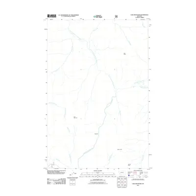
2011 Map of Lake Mountain
USGS Topo · Published 2011About this map
Lake Mountain dominates the western portion of this Lewis and Clark County landscape, where complex drainage systems define the high-country terrain. The North Fork Blackfoot River and its major tributaries, including the Dry Fork North Fork Blackfoot River and East Fork North Fork Blackfoot River, carve deep paths through the wilderness. These waters are punctuated by significant vertical drops, most notably at North Fork Falls. The survey highlights topographic landmarks that indicate the area's geological volatility and historical transit, such as the Big Slide and the appropriately named Windy Pass. Smaller drainages like Jakey Creek and Madison Creek feed the larger river system, while heights like Mineral Hill and Falls Point provide prominent navigational waypoints. This area reflects a wilderness interior primarily shaped by water and elevation, with few signs of permanent human habitation beyond the names assigned to its peaks and waterways.
Find a feature on this map
18 named features on this map. Tap any name to fly to it.
Don’t see what you’re looking for? This feature index may not catch every label — zoom into the map to look around manually.
Map Details
Editions of this 2011 Lake Mountain Map
This is the sole edition of this map. No revisions or reprints were ever made.
Other maps of this area

1902 · Ovando
USGS Topo · 1:125,000

1903 · Coopers Lake
USGS Topo · 1:125,000

1905 · Ovando
USGS Topo · 1:125,000

1955 · Choteau
USGS Topo · 1:250,000

1957 · Choteau
USGS Topo · 1:250,000

1958 · Choteau
USGS Topo · 1:250,000

1962 · Choteau
USGS Topo · 1:250,000

1968 · Spread Mountain
USGS Topo · 1:24,000

1968 · Olson Peak
USGS Topo · 1:24,000
1968 · Coopers Lake
USGS Topo · 1:24,000