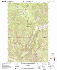
1999 Map of Lake Mountain
USGS Topo · Published 2003About this map
Scapegoat Wilderness dominates this mountainous landscape at the turn of the millennium, where the headwaters of the Blackfoot River system converge. The map illustrates a complex network of forest management and primitive access, centered on the North Fork Guard Sta and the nearby North Fork Cabin. High-altitude terrain is defined by Lake Mountain and the steep descents into Falls Creek Canyon, while the valley floors contain named points like Sourdough Flats. Drainage patterns are precisely detailed, following the Dry Fork Blackfoot River and North Fork Blackfoot River through a series of dramatic drops, including North Fork Falls. This 1999 revision highlights the intersections of the Lolo National Forest, Helena National Forest, and the Lewis and Clark and Powell county lines, reflecting the remote character of the Continental Divide backcountry.
Find a feature on this map
36 named features on this map. Tap any name to fly to it.
Don’t see what you’re looking for? This feature index may not catch every label — zoom into the map to look around manually.
Map Details
Editions of this 1999 Lake Mountain Map
This is the sole edition of this map. No revisions or reprints were ever made.
Other maps of this area

1902 · Ovando
USGS Topo · 1:125,000

1903 · Coopers Lake
USGS Topo · 1:125,000

1905 · Ovando
USGS Topo · 1:125,000

1955 · Choteau
USGS Topo · 1:250,000

1957 · Choteau
USGS Topo · 1:250,000

1958 · Choteau
USGS Topo · 1:250,000

1962 · Choteau
USGS Topo · 1:250,000

1968 · Spread Mountain
USGS Topo · 1:24,000

1968 · Olson Peak
USGS Topo · 1:24,000
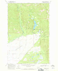
1968 · Coopers Lake
USGS Topo · 1:24,000