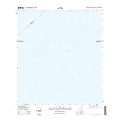
2015 Map of Lake Okeechobee 1 (All Water)
USGS Topo · Published 2015About this map
Lake Okeechobee dominates this 2015 hydrographic study, which focuses entirely on the open water of Florida's largest freshwater lake. Unlike typical land-based surveys, this map captures the mid-lake environment where the boundaries of three South Florida counties meet. The convergence of Okeechobee Co Martin Co and Martin Co Palm Beach Co are delineated by precise coordinate lines across the surface of the water, illustrating how administrative jurisdictions are maintained even in the absence of terrestrial landmarks. This specific quadrangle, noted as an all-water sheet, provides a clear view of the lake's central expanse before reaching the developed shorelines of the surrounding counties.
Find a feature on this map
3 named features on this map. Tap any name to fly to it.
Don’t see what you’re looking for? This feature index may not catch every label — zoom into the map to look around manually.
Map Details
Editions of this 2015 Lake Okeechobee 1 (All Water) Map
This is the sole edition of this map. No revisions or reprints were ever made.
Other maps of this area

1953 · Okeechobee 4 SW
USGS Topo · 1:24,000

1953 · Okeechobee SW
USGS Topo · 1:24,000

1956 · West Palm Beach
USGS Topo · 1:250,000

1956 · Fort Pierce
USGS Topo · 1:250,000

1957 · West Palm Beach
USGS Topo · 1:250,000

1958 · Fort Pierce
USGS Topo · 1:250,000

1958 · West Palm Beach
USGS Topo · 1:250,000

1959 · Fort Pierce
USGS Topo · 1:250,000

1970 · Pahokee
USGS Topo · 1:24,000
1971 · Clewiston North
USGS Topo · 1:24,000