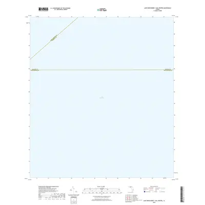
2018 Map of Lake Okeechobee 1 (All Water)
USGS Topo · Published 2018About this map
Lake Okeechobee dominates this 2018 survey, which focuses entirely on the open water and jurisdictional boundaries within the northern portion of Florida's largest freshwater lake. The map illustrates the convergence of three separate administrative areas, defined by the Okeechobee Co Martin Co line cutting diagonally across the northwestern corner and the Martin Co Palm Beach Co line running horizontally through the center. As an "All Water" quadrangle, the sheet provides a precise look at the bathymetry and nautical borders of the lake's interior during the early 21st century, stripped of shoreline distractions. This specific area serves as a critical junction for water management and county governance in the heart of South Florida.
Find a feature on this map
3 named features on this map. Tap any name to fly to it.
Don’t see what you’re looking for? This feature index may not catch every label — zoom into the map to look around manually.
Map Details
Editions of this 2018 Lake Okeechobee 1 (All Water) Map
This is the sole edition of this map. No revisions or reprints were ever made.
Other maps of this area

1953 · Okeechobee 4 SW
USGS Topo · 1:24,000

1953 · Okeechobee SW
USGS Topo · 1:24,000

1956 · West Palm Beach
USGS Topo · 1:250,000

1956 · Fort Pierce
USGS Topo · 1:250,000

1957 · West Palm Beach
USGS Topo · 1:250,000

1958 · Fort Pierce
USGS Topo · 1:250,000

1958 · West Palm Beach
USGS Topo · 1:250,000

1959 · Fort Pierce
USGS Topo · 1:250,000

1970 · Pahokee
USGS Topo · 1:24,000
1971 · Clewiston North
USGS Topo · 1:24,000