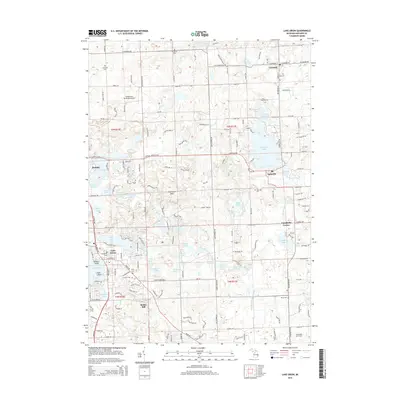
2014 Map of Lake Orion
USGS Topo · Published 2014About this map
Lake Orion serves as the focal point of this northern Oakland County landscape, surrounded by a dense network of smaller glacial lakes and established residential communities. The map depicts a transitional geography where the suburban reach of Lake Orion meets more agricultural and open lands to the north and east near Leonard and Lakeville. Significant local history is preserved in the location of numerous burial grounds, including Kingsbury Cem, Perry Cem, and the Lakeville Cem. The terrain is defined by the Grampian Hills and a complex water system including Indian Lake, Shadow Lake, and Bunny Run Lake. Aviation history is represented by the Sky Ranch Airport west of the hills, while the village of Rudds Mill and the crossroads at Campbells Corner show the enduring layout of older rural settlements in the township.
Find a feature on this map
89 named features on this map. Tap any name to fly to it.
Don’t see what you’re looking for? This feature index may not catch every label — zoom into the map to look around manually.
Map Details
Editions of this 2014 Lake Orion Map
This is the sole edition of this map. No revisions or reprints were ever made.
Other maps of this area

1907 · Pontiac
USGS Topo · 1:62,500

1908 · Rochester
USGS Topo · 1:62,500

1936 · Rochester
USGS Topo · 1:31,680

1936 · Washington
USGS Topo · 1:31,680

1936 · Pontiac North
USGS Topo · 1:31,680

1943 · Pontiac North
USGS Topo · 1:24,000

1943 · Lake Orion
USGS Topo · 1:24,000

1943 · Oxford
USGS Topo · 1:24,000

1943 · Metamora
USGS Topo · 1:24,000

1943 · Romeo
USGS Topo · 1:24,000
Featured Places
- Orion Charter Township, MI
- Oxford Charter Township, MI
- Oakland Charter Township, MI
- Addison Township, MI
- Oxford, MI