
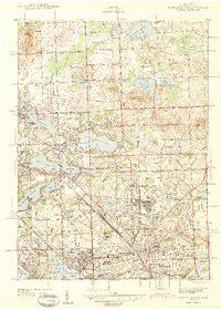
1943 Map of Pontiac North
USGS Topo · Published 1943About this map
Pontiac anchors this 1941 landscape, a bustling city surrounded by a dense network of suburban developments and glacial lakes. The extensive grounds of the Pontiac State Hospital and County Homes define the transition between the urban core and the developing townships of Waterford and Orion. This era captures the region's mid-century expansion, evidenced by the numerous schoolhouses such as Weyer Sch and Malkim Sch dotting the outskirts of established centers like Drayton Plains.
Find a feature on this map
102 named features on this map. Tap any name to fly to it.
Don’t see what you’re looking for? This feature index may not catch every label — zoom into the map to look around manually.
Map Details
Editions of this 1943 Pontiac North Map
2 editions found
Other maps of this area

1907 · Pontiac
USGS Topo · 1:62,500

1908 · Rochester
USGS Topo · 1:62,500

1936 · Birmingham
USGS Topo · 1:31,680

1936 · Clarkston
USGS Topo · 1:31,680

1936 · Rochester
USGS Topo · 1:31,680

1936 · Walled Lake
USGS Topo · 1:31,680

1936 · Pontiac South
USGS Topo · 1:31,680

1936 · Pontiac North
USGS Topo · 1:31,680

1943 · Clarkston
USGS Topo · 1:24,000

1943 · Pontiac South
USGS Topo · 1:24,000
Featured Places
- Waterford Township, MI
- Pontiac, MI
- Orion Charter Township, MI
- Independence Charter Township, MI
- Auburn Hills, MI