
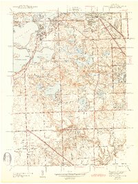
1943 Map of Pontiac South
USGS Topo · Published 1943About this map
Pontiac anchors the northeast corner of this 1940s landscape, which transitions from the urban grid of the city to a mosaic of inland lakes and private estates. The area is defined by its recreation-driven development, featuring an extraordinary concentration of sporting grounds such as the Oakland Hills Country Club and Tam O'Shanter Country Club. These clubs are woven between numerous water bodies, including the large basins of Cass Lake, Orchard Lake, and Walnut Lake.
Find a feature on this map
92 named features on this map. Tap any name to fly to it.
Don’t see what you’re looking for? This feature index may not catch every label — zoom into the map to look around manually.
Map Details
Editions of this 1943 Pontiac South Map
2 editions found
Other maps of this area

1905 · Wayne
USGS Topo · 1:62,500

1905 · Detroit
USGS Topo · 1:62,500

1907 · Pontiac
USGS Topo · 1:62,500

1908 · Rochester
USGS Topo · 1:62,500

1912 · Wayne
USGS Topo · 1:62,500

1918 · Detroit
USGS Topo · 1:62,500

1924 · Detroit
USGS Topo · 1:62,500

1934 · Detroit
USGS Topo · 1:62,500

1936 · Birmingham
USGS Topo · 1:31,680

1936 · Clarkston
USGS Topo · 1:31,680