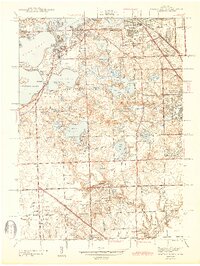
1943 Map of Pontiac South
USGS Topo · Published 1943About this map
The glacial lake district of southern Oakland County is showcased here just as suburban expansion began to reshape the landscape. Centered on the sprawling waters of Cass Lake, Orchard Lake, and Pine Lake, the map documents a transition from a recreational lakefront community to a more permanent residential network. Prominent institutional landmarks include the St Marys College and Polish Seminary on Orchard Lake and the Protestant Childrens Home of Detroit, while the Grand Trunk Western RR cuts through the northern section, connecting Keego Harbor and Sylvan Village toward the industrial hub of Pontiac. To the south, the emergence of affluent residential developments is signaled by numerous recreational spaces, including the Oakland Hills Country Club and Bloomfield Hills Country Club. The presence of the Airway Beacon and several children's homes, like the Sarah Fisher Childrens Home, reflects the area's service as a regional institutional center in the early 1940s.
Find a feature on this map
74 named features on this map. Tap any name to fly to it.
Don’t see what you’re looking for? This feature index may not catch every label — zoom into the map to look around manually.
Map Details
Editions of this 1943 Pontiac South Map
2 editions found

Other maps of this area

1905 · Wayne
USGS Topo · 1:62,500

1905 · Detroit
USGS Topo · 1:62,500

1907 · Pontiac
USGS Topo · 1:62,500

1908 · Rochester
USGS Topo · 1:62,500

1912 · Wayne
USGS Topo · 1:62,500

1918 · Detroit
USGS Topo · 1:62,500

1924 · Detroit
USGS Topo · 1:62,500

1934 · Detroit
USGS Topo · 1:62,500

1936 · Birmingham
USGS Topo · 1:31,680

1936 · Clarkston
USGS Topo · 1:31,680