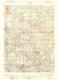
1943 Map of Pontiac North
USGS Topo · Published 1943About this map
The expanding northern limits of Pontiac during the early 1940s reveal a landscape transitioning from glacial lake country to a structured suburban and institutional hub. Large facilities such as the Pontiac State Hospital and Pontiac General Hospital anchor the city’s footprint, while the Grand Trunk Western railroad provides a heavy industrial spine. The map documents an era of residential growth in planned developments like La Salle Gardens, Huron Gardens, and Elizabeth Lake Estates, which began to fill the spaces between the city center and the numerous water bodies to the west.
Find a feature on this map
112 named features on this map. Tap any name to fly to it.
Don’t see what you’re looking for? This feature index may not catch every label — zoom into the map to look around manually.
Map Details
Editions of this 1943 Pontiac North Map
2 editions found

Other maps of this area

1907 · Pontiac
USGS Topo · 1:62,500

1908 · Rochester
USGS Topo · 1:62,500

1936 · Birmingham
USGS Topo · 1:31,680

1936 · Clarkston
USGS Topo · 1:31,680

1936 · Rochester
USGS Topo · 1:31,680

1936 · Walled Lake
USGS Topo · 1:31,680

1936 · Pontiac South
USGS Topo · 1:31,680

1936 · Pontiac North
USGS Topo · 1:31,680

1943 · Clarkston
USGS Topo · 1:24,000

1943 · Pontiac South
USGS Topo · 1:24,000
Featured Places
- Waterford Township, MI
- Pontiac, MI
- Orion Charter Township, MI
- Independence Charter Township, MI
- Auburn Hills, MI