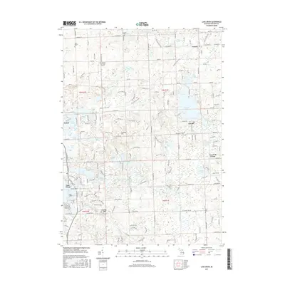
2017 Map of Lake Orion
USGS Topo · Published 2017About this map
Lake Orion and its surrounding glacial lake district define this portion of Oakland County in the late 2010s. The landscape is a complex of wetlands and water bodies, including Indian Lake, Lakeville Lake, and Bunny Run Lake, many of which are linked by the West Branch Stony Creek. The historical agricultural and milling roots of the area are still visible at Rudds Mill and through numerous burial grounds like Kingsbury Cem and Evergreen Cem.
Find a feature on this map
104 named features on this map. Tap any name to fly to it.
Don’t see what you’re looking for? This feature index may not catch every label — zoom into the map to look around manually.
Map Details
Editions of this 2017 Lake Orion Map
This is the sole edition of this map. No revisions or reprints were ever made.
Other maps of this area

1907 · Pontiac
USGS Topo · 1:62,500

1908 · Rochester
USGS Topo · 1:62,500

1936 · Rochester
USGS Topo · 1:31,680

1936 · Washington
USGS Topo · 1:31,680

1936 · Pontiac North
USGS Topo · 1:31,680

1943 · Pontiac North
USGS Topo · 1:24,000

1943 · Lake Orion
USGS Topo · 1:24,000

1943 · Oxford
USGS Topo · 1:24,000

1943 · Metamora
USGS Topo · 1:24,000

1943 · Romeo
USGS Topo · 1:24,000
Featured Places
- Orion Charter Township, MI
- Oxford Charter Township, MI
- Oakland Charter Township, MI
- Addison Township, MI
- Oxford, MI