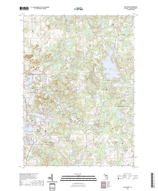
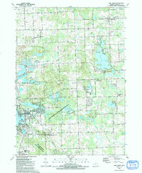
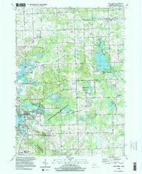
2023 Map of Lake Orion
USGS Topo · Published 2023About this map
Lake Orion and Oxford anchor this pocket of northern Oakland County, where the landscape is defined by a dense concentration of glacial kettle lakes and evolving recreational spaces. The village of Lake Orion is particularly intricate, showing residential growth around Buckhorn Lake and Lake Orion, while the former rail corridor of the Polly Ann State Trl passes through Oxford to the north. Smaller settlements like Lakeville, Leonard, and Rudds Mill preserve the historical footprint of rural crossroads and milling sites.
Find a feature on this map
79 named features on this map. Tap any name to fly to it.
Don’t see what you’re looking for? This feature index may not catch every label — zoom into the map to look around manually.
Map Details
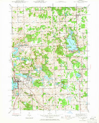
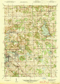
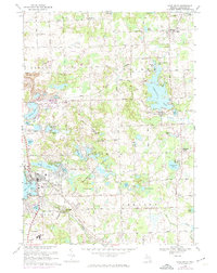
Editions of this 2023 Lake Orion Map
This is the sole edition of this map. No revisions or reprints were ever made.
Historical Maps of Campbells Corner Through Time
6 maps found
Featured Locations
- Addison Township, MI
- Oakland Charter Township, MI
- Orion Charter Township, MI
- Oxford Charter Township, MI
- Oxford, Oxford Charter Township