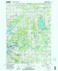
1996 Map of Lake Orion
USGS Topo · Published 1999About this map
Lake Orion serves as the focal point for this section of Oakland County, reflecting a landscape where glacial lake clusters and conservation areas define the settlement pattern. In the late 20th century, the transition from rural crossroads to suburban recreation is evident in the proximity of Bald Mountain State Recreation Area and Addison Oaks County Park to established villages. The map documents smaller historic communities such as Leonard, Lakeville, and the former hamlet of Oakwood, alongside industrial markers like the Gas Field and various Gravel Pits. Genealogists may find value in the locations of North Oxford Cem and Kline Cem, while aviation history is preserved at the Woodward Landing Field. An Old Railroad Grade cutting across the terrain serves as a reminder of the region's earlier transportation network.
Find a feature on this map
86 named features on this map. Tap any name to fly to it.
Don’t see what you’re looking for? This feature index may not catch every label — zoom into the map to look around manually.
Map Details
Editions of this 1996 Lake Orion Map
This is the sole edition of this map. No revisions or reprints were ever made.
Other maps of this area

1907 · Pontiac
USGS Topo · 1:62,500

1908 · Rochester
USGS Topo · 1:62,500

1936 · Rochester
USGS Topo · 1:31,680

1936 · Washington
USGS Topo · 1:31,680

1936 · Pontiac North
USGS Topo · 1:31,680

1943 · Pontiac North
USGS Topo · 1:24,000

1943 · Lake Orion
USGS Topo · 1:24,000

1943 · Oxford
USGS Topo · 1:24,000

1943 · Metamora
USGS Topo · 1:24,000

1943 · Romeo
USGS Topo · 1:24,000
Featured Places
- Orion Charter Township, MI
- Oxford Charter Township, MI
- Oakland Charter Township, MI
- Addison Township, MI
- Oxford, MI