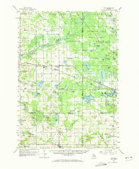
1959 Map of Lake
USGS Topo · Published 1973About this map
The confluence of Osceola, Mecosta, Clare, and Isabella counties defines this mid-century landscape of glacial lakes and river systems. The Muskegon River flows through the northern sections, while the Chippewa River and the Middle Branch carve paths through the central and southern townships. Small settlements like Sears and Barryton anchor the local economy, which by 1959 was heavily influenced by the Oil Field and numerous Gravel Pits scattered across the terrain.
Find a feature on this map
109 named features on this map. Tap any name to fly to it.
Don’t see what you’re looking for? This feature index may not catch every label — zoom into the map to look around manually.
Map Details
Editions of this 1959 Lake Map
2 editions found

Other maps of this area

1916 · Mount Pleasant
USGS Topo · 1:62,500

1919 · Mount Pleasant
USGS Topo · 1:62,500

1943 · Mount Pleasant
USGS Topo · 1:62,500

1954 · Traverse City
USGS Topo · 1:250,000

1954 · Midland
USGS Topo · 1:250,000

1957 · Harrison
USGS Topo · 1:62,500

1957 · Cadillac South
USGS Topo · 1:62,500

1957 · Marion
USGS Topo · 1:62,500

1958 · Traverse City
USGS Topo · 1:250,000

1958 · Midland
USGS Topo · 1:250,000