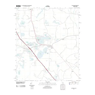
2011 Map of Lake Park
USGS Topo · Published 2011About this map
Lake Park and the surrounding lowland landscape are defined by an intricate network of water bodies, varying from the expansive Ocean Pond and Long Pond to smaller features like Saddle Bags Pond and Nasty Pond. This 2011 survey by the U.S. Geological Survey shows a settlement pattern heavily influenced by the local geography, with towns like Dasher, Herring, and Melrose connected by a grid of rural roads and rail lines. The presence of Lake Park Cemetery and family-named features like Browns Pond and Carrolls Pond indicates a long history of local land use. The hydrography of the region is further complexified by drainage systems such as Caney Branch and the Alapahoochee River, while localized developments at Twin Lakes suggest a transition toward residential and recreational use of the many natural ponds that dot this portion of Georgia.
Find a feature on this map
86 named features on this map. Tap any name to fly to it.
Don’t see what you’re looking for? This feature index may not catch every label — zoom into the map to look around manually.
Map Details
Editions of this 2011 Lake Park Map
This is the sole edition of this map. No revisions or reprints were ever made.
Other maps of this area

1954 · Valdosta
USGS Topo · 1:250,000

1956 · Clyattville
USGS Topo · 1:24,000

1956 · Jennings
USGS Topo · 1:24,000

1956 · Octahatchee
USGS Topo · 1:24,000

1958 · Valdosta
USGS Topo · 1:250,000

1959 · Valdosta
USGS Topo · 1:250,000

1960 · Pinetta
USGS Topo · 1:24,000

1961 · Valdosta
USGS Topo · 1:24,000

1971 · Indianola
USGS Topo · 1:24,000

1971 · Howell
USGS Topo · 1:24,000