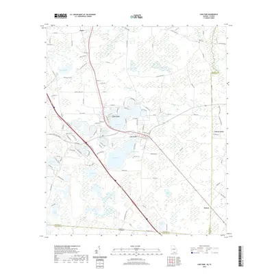
2020 Map of Lake Park
USGS Topo · Published 2020About this map
Lake Park serves as the central hub of this South Georgia landscape, situated in a lake-dense region just north of the Georgia Florida state line. The map highlights a complex hydrographic network, where larger bodies like Ocean Pond and Long Pond are interspersed with smaller named features such as Schoolhouse Pond and Saddle Bags Pond. The settlement pattern follows the established transit corridors, with Dasher to the north and the community of Melrose appearing in the southeast.
Find a feature on this map
102 named features on this map. Tap any name to fly to it.
Don’t see what you’re looking for? This feature index may not catch every label — zoom into the map to look around manually.
Map Details
Editions of this 2020 Lake Park Map
This is the sole edition of this map. No revisions or reprints were ever made.
Other maps of this area

1954 · Valdosta
USGS Topo · 1:250,000

1956 · Clyattville
USGS Topo · 1:24,000

1956 · Jennings
USGS Topo · 1:24,000

1956 · Octahatchee
USGS Topo · 1:24,000

1958 · Valdosta
USGS Topo · 1:250,000

1959 · Valdosta
USGS Topo · 1:250,000

1960 · Pinetta
USGS Topo · 1:24,000

1961 · Valdosta
USGS Topo · 1:24,000

1971 · Indianola
USGS Topo · 1:24,000

1971 · Howell
USGS Topo · 1:24,000