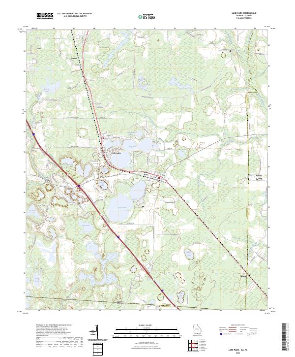
2024 Map of Lake Park
USGS Topo · Published 2024About this map
Lake Park and its surrounding lake-strewn landscape are defined by a high concentration of water bodies along the Interstate 75 corridor south of Valdosta. This modern survey illustrates the proximity of Twin Lakes and Long Pond to established residential and recreational areas. The dense collection of named lakes, including Ocean Pond, Clayton Lake, and Horseshoe Lake, suggests a geography historically shaped by solution-depressions common to the South Georgia landscape. In the northern reaches, the Mud Swamp and Grand Bay Creek drainage systems emphasize the low-lying, riparian nature of the terrain. Cultural landmarks such as Lake Park Cem and the small settlements of Dasher and Melrose anchor the community history. Large land tracts like the Farm Service Agency Interest of Georgia near the Echols County line indicate significant managed land use alongside the Alapahoochee River's headwaters.
Find a feature on this map
139 named features on this map. Tap any name to fly to it.
Don’t see what you’re looking for? This feature index may not catch every label — zoom into the map to look around manually.
Map Details
Editions of this 2024 Lake Park Map
This is the sole edition of this map. No revisions or reprints were ever made.
Other maps of this area

1954 · Valdosta
USGS Topo · 1:250,000

1956 · Clyattville
USGS Topo · 1:24,000

1956 · Jennings
USGS Topo · 1:24,000

1956 · Octahatchee
USGS Topo · 1:24,000

1958 · Valdosta
USGS Topo · 1:250,000

1959 · Valdosta
USGS Topo · 1:250,000

1960 · Pinetta
USGS Topo · 1:24,000

1961 · Valdosta
USGS Topo · 1:24,000

1971 · Indianola
USGS Topo · 1:24,000

1971 · Howell
USGS Topo · 1:24,000