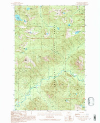
1989 Map of Lake Philippa
USGS Topo · Published 1989About this map
The Middle Fork Snoqualmie River carves through the heart of this landscape, reflecting a rugged wilderness interior in King County during the late 1980s. This territory is defined by the high peaks of the Snoqualmie National Forest, including Bessemer Mountain and Garfield Mountain, which overlook a complex system of alpine water bodies. The presence of a Mine Shaft and an Adit near Quartz Creek points to the area's history of mineral prospecting, while a simple Footbridge and scattered 4wd tracks indicate the limited reach of infrastructure into the Alpine Lakes Wilderness. A notable concentration of high-altitude lakes, such as Lake Philippa and Upper Loch Katrine, illustrates the glacially carved terrain that defines the drainage patterns of the Pratt River and Taylor River.
Find a feature on this map
46 named features on this map. Tap any name to fly to it.
Don’t see what you’re looking for? This feature index may not catch every label — zoom into the map to look around manually.
Map Details
Editions of this 1989 Lake Philippa Map
3 editions found
Other maps of this area

1901 · Snoqualmie Pass
USGS Topo · 1:125,000

1902 · Skykomish
USGS Topo · 1:125,000

1903 · Snoqualmie
USGS Topo · 1:125,000

1905 · Skykomish
USGS Topo · 1:125,000

1913 · Cedar Lake
USGS Topo · 1:125,000

1921 · Sultan
USGS Topo · 1:125,000

1923 · Sultan
USGS Topo · 1:125,000

1957 · Wenatchee
USGS Topo · 1:250,000

1960 · Mount Si
USGS Topo · 1:62,500

1960 · Bandera
USGS Topo · 1:62,500