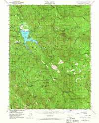
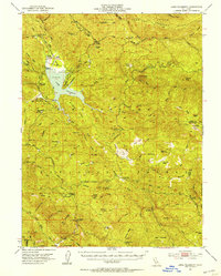
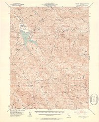
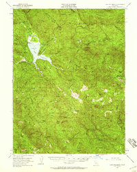
1951 Map of Lake Pillsbury
USGS Topo · Published 1967About this map
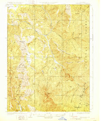
Lake Pillsbury and its surrounding mountain ranges dominate this Mendocino National Forest landscape during the mid-century era. The reservoir is anchored by Scott Dam, where the Eel River and numerous tributaries like Rice Creek and Soda Creek converge. The mapping shows a working wilderness where recreational and government interests meet, featuring the Soda Creek Guard Sta and the Elk Mountain Guard Sta alongside several campgrounds and a dedicated Landing Field.
Find a feature on this map
87 named features on this map. Tap any name to fly to it.
Don’t see what you’re looking for? This feature index may not catch every label — zoom into the map to look around manually.
Map Details
Editions of this 1951 Lake Pillsbury Map
5 editions found

Other maps of this area

1919 · Elk Creek
USGS Topo · 1:62,500

1920 · Ukiah
USGS Topo · 1:62,500

1922 · Hullville
USGS Topo · 1:62,500

1924 · Bartlett Springs
USGS Topo · 1:62,500
1929 · Eden Valley
USGS Topo · 1:62,500

1938 · Lakeport
USGS Topo · 1:62,500

1942 · Bartlett Springs
USGS Topo · 1:62,500

1943 · Pomo
USGS Topo · 1:62,500

1944 · Bartlett Springs
USGS Topo · 1:62,500

1944 · Ukiah
USGS Topo · 1:62,500