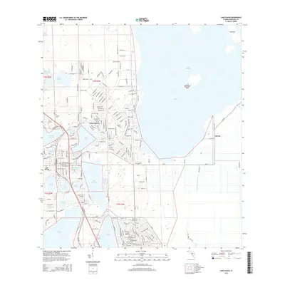
2015 Map of Lake Placid
USGS Topo · Published 2015About this map
Lake Placid serves as the focal point of this Highlands County landscape, where numerous freshwater bodies define the community's layout and residential growth. This 2015 survey details a complex geography of interlocking lakes, ranging from the expansive Lake Istokpoga and Lake June in Winter to smaller interior basins like Lake Huntley, Lake McCoy, and Mirror Lake. The settlement pattern follows the shorelines, with development concentrated in Sylvan Shores and the southern reaches near Lake Placid. Genealogists may find interest in the location of Oak Hill Cem, while the inclusion of the Bumblebee Island and Big Island markers within Lake Istokpoga highlights the aquatic nature of the local terrain. The road network, featuring thoroughfares such as CR-29 and CR-621, reveals how modern infrastructure navigates the constraints of the Florida lake country, connecting dispersed lakeside neighborhoods and the eastern area of Sunvale.
Find a feature on this map
140 named features on this map. Tap any name to fly to it.
Don’t see what you’re looking for? This feature index may not catch every label — zoom into the map to look around manually.
Map Details
Editions of this 2015 Lake Placid Map
This is the sole edition of this map. No revisions or reprints were ever made.
Other maps of this area

1952 · Lake Placid
USGS Topo · 1:24,000

1952 · Lorida
USGS Topo · 1:24,000

1952 · Sebring
USGS Topo · 1:24,000

1953 · Brighton NW
USGS Topo · 1:24,000

1953 · Lake June In Winter
USGS Topo · 1:24,000

1953 · Venus NW
USGS Topo · 1:24,000

1953 · Basinger SW
USGS Topo · 1:24,000

1953 · Basinger NW
USGS Topo · 1:24,000

1953 · Childs
USGS Topo · 1:24,000

1956 · Fort Pierce
USGS Topo · 1:250,000