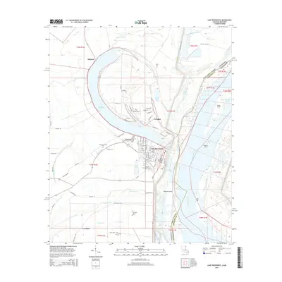
2015 Map of Lake Providence
USGS Topo · Published 2015About this map
Lake Providence defines the landscape of East Carroll Parish, its dramatic oxbow curve serving as the anchor for the regional seat and surrounding agricultural settlements. By the early 21st century, the town of Lake Providence shows a dense street grid including 1st St through 8th St, while outlying communities like Highland, Arlington, and Greenfield mark the higher ground amidst a complex network of waterways. The transition from the lake's western shore to the Mississippi River is characterized by features like Stack Island and Cottonwood Chute, illustrating the river's dynamic history. Genealogists will find several burial sites preserved across the landscape, including Old Sweet Canaan Cem and Heavenly Rest Memorial Park, alongside local infrastructure such as Byerley Airport. The map also captures the intricate drainage patterns of Tensas Bayou and Winters Bayou, which flow through the fertile alluvial plains.
Find a feature on this map
121 named features on this map. Tap any name to fly to it.
Don’t see what you’re looking for? This feature index may not catch every label — zoom into the map to look around manually.
Map Details
Editions of this 2015 Lake Providence Map
This is the sole edition of this map. No revisions or reprints were ever made.
Other maps of this area

1909 · Baxter Bayou
USGS Topo · 1:24,000

1909 · Lake Providence
USGS Topo · 1:24,000

1909 · Wilsons Point
USGS Topo · 1:24,000

1909 · Millikin
USGS Topo · 1:24,000

1909 · Ashton Bridge
USGS Topo · 1:24,000

1911 · Lake Providence
USGS Topo · 1:31,680

1911 · Baxter Bayou
USGS Topo · 1:24,000

1912 · Ashton Bridge
USGS Topo · 1:31,680

1913 · Wilson Point
USGS Topo · 1:31,680

1914 · Baxter Bayou
USGS Topo · 1:31,680