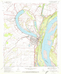
1970 Map of Lake Providence
USGS Topo · Published 1972About this map
The oxbow lake known as Lake Providence dominates this Mississippi River delta landscape, defining the layout of the parish seat at Lake Providence. This 1970 survey illustrates the town's position between the crescent lake and the massive Mississippi River, with the Missouri Pacific railroad corridor running north to south. Significant genealogical details are scattered throughout the surrounding agricultural land, including family and community landmarks such as Gailliard Cem, Tyrone Cem, and Sweet Canaan Ch Cem. The transition from river-based transport to regional infrastructure is evident in the proximity of Lake Providence Port to the Byerley Airport. Further south, the landscape is crisscrossed by a network of waterways including Tensas Bayou and Boggy Bayou, which served as critical drainage and transport routes for early settlements like Greenfield.
Find a feature on this map
60 named features on this map. Tap any name to fly to it.
Don’t see what you’re looking for? This feature index may not catch every label — zoom into the map to look around manually.
Map Details
Editions of this 1970 Lake Providence Map
This is the sole edition of this map. No revisions or reprints were ever made.
Other maps of this area

1909 · Baxter Bayou
USGS Topo · 1:24,000

1909 · Lake Providence
USGS Topo · 1:24,000

1909 · Wilsons Point
USGS Topo · 1:24,000

1909 · Millikin
USGS Topo · 1:24,000

1909 · Ashton Bridge
USGS Topo · 1:24,000

1911 · Lake Providence
USGS Topo · 1:31,680

1911 · Baxter Bayou
USGS Topo · 1:24,000

1912 · Ashton Bridge
USGS Topo · 1:31,680

1913 · Wilson Point
USGS Topo · 1:31,680

1914 · Baxter Bayou
USGS Topo · 1:31,680