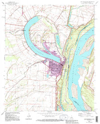
1994 Map of Lake Providence
USGS Topo · Published 1995About this map
The oxbow lake of Lake Providence anchors this landscape, reflecting a dramatic bend in the Mississippi River that has since been bypassed by the main channel. The town of Lake Providence is situated along the southern curve of its namesake lake, showing a dense street grid that serves as the regional hub for East Carroll Parish. The map reveals an intricate hydrological system where the Levee system separates the active river from the alluvial plains of the Tensas Basin.
Find a feature on this map
59 named features on this map. Tap any name to fly to it.
Don’t see what you’re looking for? This feature index may not catch every label — zoom into the map to look around manually.
Map Details
Editions of this 1994 Lake Providence Map
This is the sole edition of this map. No revisions or reprints were ever made.
Other maps of this area

1909 · Baxter Bayou
USGS Topo · 1:24,000

1909 · Lake Providence
USGS Topo · 1:24,000

1909 · Wilsons Point
USGS Topo · 1:24,000

1909 · Millikin
USGS Topo · 1:24,000

1909 · Ashton Bridge
USGS Topo · 1:24,000

1911 · Lake Providence
USGS Topo · 1:31,680

1911 · Baxter Bayou
USGS Topo · 1:24,000

1912 · Ashton Bridge
USGS Topo · 1:31,680

1913 · Wilson Point
USGS Topo · 1:31,680

1914 · Baxter Bayou
USGS Topo · 1:31,680