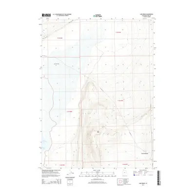
2014 Map of Lake Ridge
USGS Topo · Published 2014About this map
Lake Ridge dominates the central elevation of this Box Elder County terrain, overlooking the low-lying expanse of the Great Salt Lake to the southwest. The geography is defined by the stark contrast between the elevated ridge and the level drainage of Salt Wells Flat. To the south, the settlement of Cedar Springs is situated near the natural water source of Cedar Spring, marking a point of human activity in an otherwise sparse landscape. Transport through this portion of the Great Basin relies on established corridors like Salt Wells Rd and Hansel Valley Rd, which navigate the contours between the high ridges and the marshy edges of Spring Bay. This survey illustrates the relationship between reliable water sources and settlement patterns in the arid environment of northern Utah.
Find a feature on this map
14 named features on this map. Tap any name to fly to it.
Don’t see what you’re looking for? This feature index may not catch every label — zoom into the map to look around manually.
Map Details
Editions of this 2014 Lake Ridge Map
This is the sole edition of this map. No revisions or reprints were ever made.
Other maps of this area

1954 · Brigham City
USGS Topo · 1:250,000

1958 · Brigham City
USGS Topo · 1:250,000

1962 · Brigham City
USGS Topo · 1:250,000

1967 · Golden Spike Monument
USGS Topo · 1:24,000

1968 · Rozel
USGS Topo · 1:24,000

1968 · Lake Ridge
USGS Topo · 1:24,000

1968 · Sunset Pass
USGS Topo · 1:24,000

1968 · Monument Point
USGS Topo · 1:24,000

1968 · Coyote Point
USGS Topo · 1:24,000

1968 · Salt Wells
USGS Topo · 1:24,000