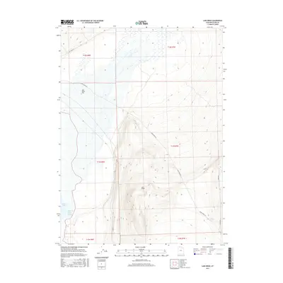
2017 Map of Lake Ridge
USGS Topo · Published 2017About this map
Lake Ridge stands as the central topographical spine in this portion of Box Elder County, dividing the basin floor from the shoreline of the Great Salt Lake. The landscape transitions sharply from the expansive, level terrain of Salt Wells Flat in the north to the elevated contours of the ridge, where local water sources like Cedar Spring and the marshy edges of Spring Bay defined the viability of this arid region. The presence of Cedar Springs Rd and Salt Wells Rd indicates the established corridors used to navigate the foothills and salt flats, providing a clear record of the rural infrastructure connecting these remote points of interest in northern Utah during the late 2010s.
Find a feature on this map
14 named features on this map. Tap any name to fly to it.
Don’t see what you’re looking for? This feature index may not catch every label — zoom into the map to look around manually.
Map Details
Editions of this 2017 Lake Ridge Map
This is the sole edition of this map. No revisions or reprints were ever made.
Other maps of this area

1954 · Brigham City
USGS Topo · 1:250,000

1958 · Brigham City
USGS Topo · 1:250,000

1962 · Brigham City
USGS Topo · 1:250,000

1967 · Golden Spike Monument
USGS Topo · 1:24,000

1968 · Rozel
USGS Topo · 1:24,000

1968 · Lake Ridge
USGS Topo · 1:24,000

1968 · Sunset Pass
USGS Topo · 1:24,000

1968 · Monument Point
USGS Topo · 1:24,000

1968 · Coyote Point
USGS Topo · 1:24,000

1968 · Salt Wells
USGS Topo · 1:24,000