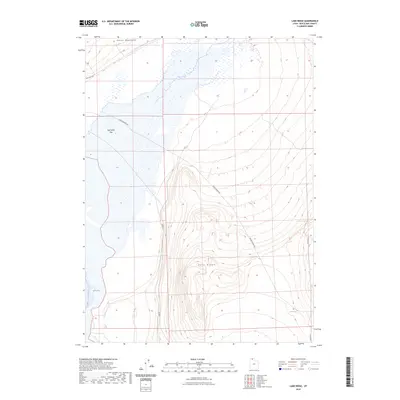
2023 Map of Lake Ridge
USGS Topo · Published 2023About this map
The Hansel Mountains rise above the high-desert basins of Box Elder County, defining a landscape shaped by ancient shorelines and sparse water sources. The elevation transitions from the expansive Salt Wells Flat in the north toward the central prominence of Lake Ridge. This area is characterized by the vast wetlands and mudflats near Spring Bay, where seasonal water patterns dictate the geography. Transportation is limited to a few established routes like Salt Wells Rd and Cedar Springs Rd, which connect remote landmarks such as Cedar Spring. This 2023 survey provides a clear view of the natural topography and hydrologic features in a largely uninhabited portion of northern Utah, serving as a vital reference for understanding the region's current drainage and landforms.
Find a feature on this map
7 named features on this map. Tap any name to fly to it.
Don’t see what you’re looking for? This feature index may not catch every label — zoom into the map to look around manually.
Map Details
Editions of this 2023 Lake Ridge Map
This is the sole edition of this map. No revisions or reprints were ever made.
Other maps of this area

1954 · Brigham City
USGS Topo · 1:250,000

1958 · Brigham City
USGS Topo · 1:250,000

1962 · Brigham City
USGS Topo · 1:250,000

1967 · Golden Spike Monument
USGS Topo · 1:24,000

1968 · Rozel
USGS Topo · 1:24,000

1968 · Lake Ridge
USGS Topo · 1:24,000

1968 · Sunset Pass
USGS Topo · 1:24,000

1968 · Monument Point
USGS Topo · 1:24,000

1968 · Coyote Point
USGS Topo · 1:24,000

1968 · Salt Wells
USGS Topo · 1:24,000