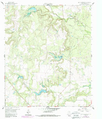
1960 Map of Lake Scarborough
USGS Topo · Published 1988About this map
Lake Scarborough serves as a central hydrological landmark in this northern Coleman County landscape, where the Spillway and the Coleman Filtration Plant manage the local water supply. The map captures a mid-century period of energy extraction and utility development, characterized by the Anz Morris Oil Field and various Oil Wells scattered across the undulating terrain. A distinct network of drainage basins, including Turtle Bayou, Ned Creek, and Indian Creek, defines the natural topography. Transportation and infrastructure are represented by a local Landing Strip and a Pipeline cutting through the western portion of the quadrangle. Significant landmarks like Buck Hollow provide traditional geographic orientation amidst the industrial activity of the Texas oil patch during this era of post-war growth.
Find a feature on this map
13 named features on this map. Tap any name to fly to it.
Don’t see what you’re looking for? This feature index may not catch every label — zoom into the map to look around manually.
Map Details
Editions of this 1960 Lake Scarborough Map
2 editions found

Other maps of this area

1887 · Coleman
USGS Topo · 1:125,000

1889 · Coleman
USGS Topo · 1:125,000

1890 · Abilene
USGS Topo · 1:125,000

1892 · Abilene
USGS Topo · 1:125,000

1892 · Ballinger
USGS Topo · 1:125,000

1931 · Baird
USGS Topo · 1:125,000

1932 · Baird
USGS Topo · 1:125,000

1954 · Brownwood
USGS Topo · 1:250,000

1954 · Abilene
USGS Topo · 1:250,000

1958 · Abilene
USGS Topo · 1:250,000